


Blog 9
23rd – 27th April
Akespe to the border
Distance: 305km
Total Distance: 2286km
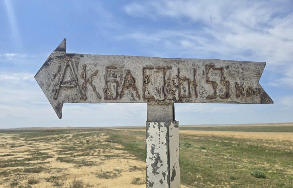
Day 31: Akespe to Akbasty – 104km
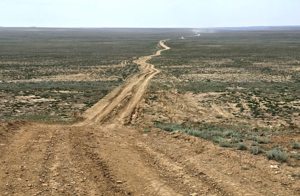
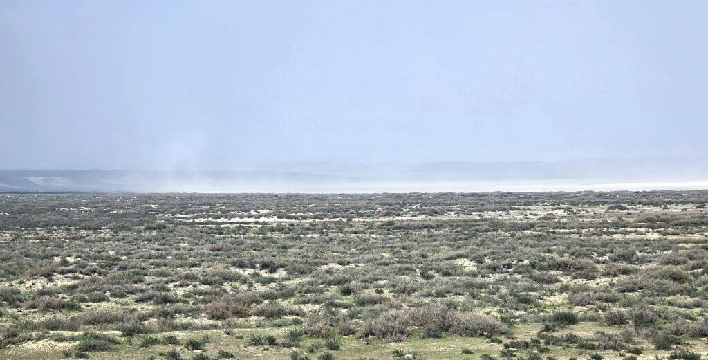
Once out of the sand at Akespe, it was a relief to turn onto the Gas Pipeline Road – the first made gravel road I’ve had since Aralsk. It follows a buried gas pipeline that runs all the way through to Uzbekistan (unfortunately not the good road though). The steppe landscape was vast with a few mesas keeping the landscape interesting – at one point, quite spectacular.
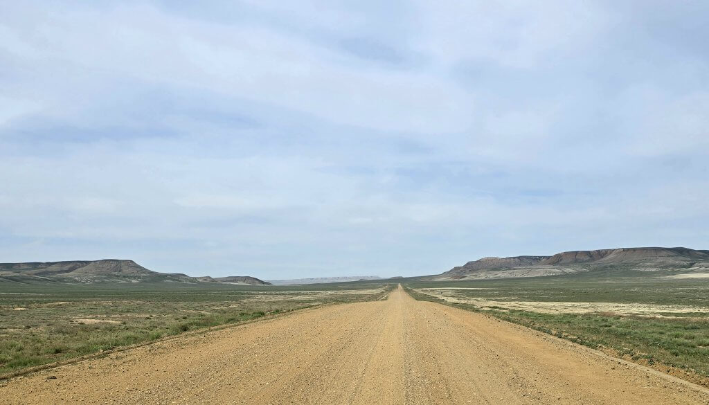
After 52km we turned off onto a short cut to Akbasty, saving 30km. Winding through a flat terrain, the surface was pretty good – all powdery clay and dried mud as well as some sand. Most of the time we stayed about seven kilometres from the coast of Aral Sea North. The wind gusts swirled around from different directions during the day.
On the final section, 26km along the main track to Akbasty, atop the undulations it was possible to glimpse the sea at times. The air was hazy with fine, salty dust that was being whipped up in the strong winds. The atmosphere was thick to breathe and the particles filtered the late afternoon light, dimming the sun and leaving no shadows. The hazy conditions and filtered light were reminiscent of those I experienced in the Sahel region at the base of the Sahara Desert. The final eight kilometres were very sandy. Staying in control of my bike while pushing up small sand dunes with the little strength I had left in my legs finished me off.
Akbasty felt like a tough frontier village, the last significant village standing, in a region where once there were many small communities. Sand piled up in the dusty streets, a hotchpotch of old and new houses and livestock holding yards. Although the sea is not far away, the community here are animal herders, farming horses, cattle, sheep and camels.
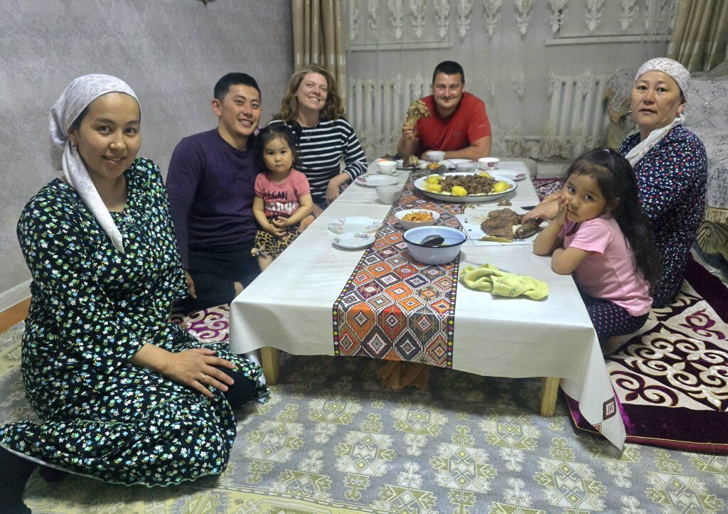
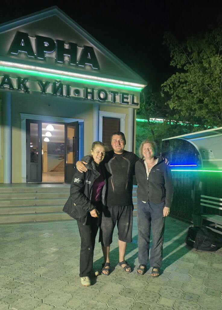
When Sasha asked about accommodation at the shop, there was none officially available, but the family who owned the shop welcomed us into their home and made our stay in this remote town very memorable.
Day 32 – Barsakelmes Nature Reserve
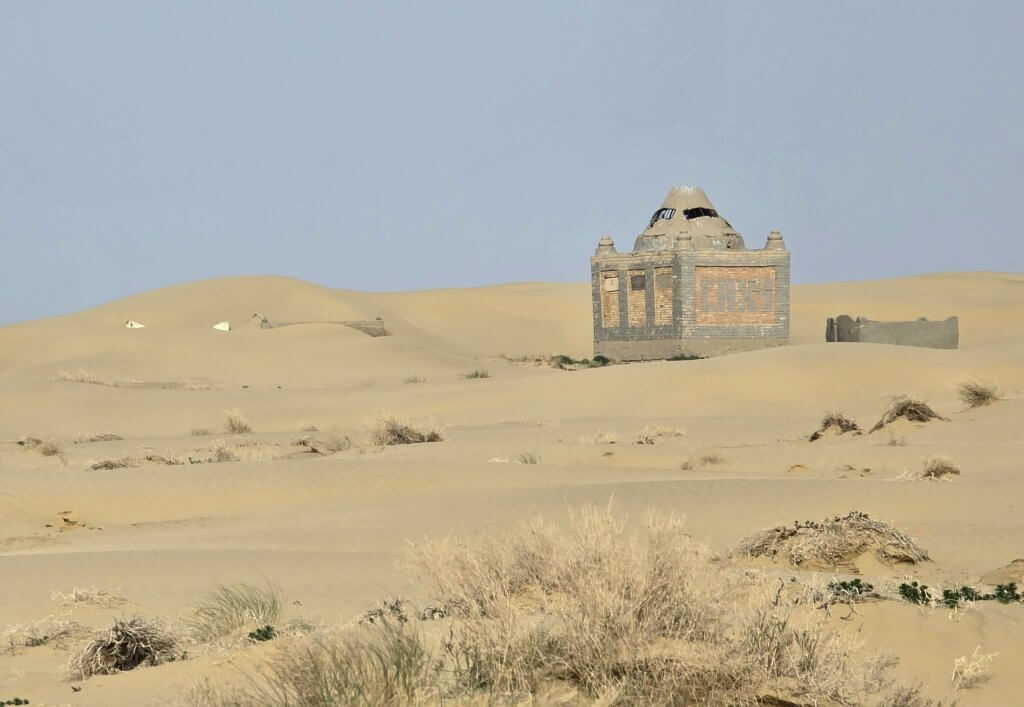
My intention in diverting to Akbasty was to visit the Barsakelmes Nature Reserve (not to be confused with Barsakelmes Island that we visited after Kokaral Dam). These regions are protected and I had negotiated permits for both Barsakelmes Island and Nature Reserve before the start of the expedition.
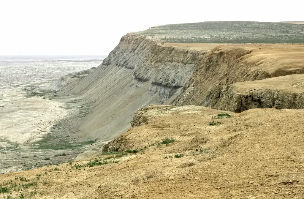
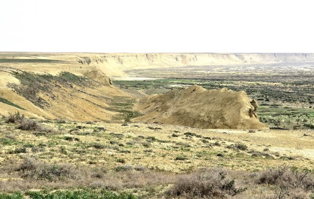
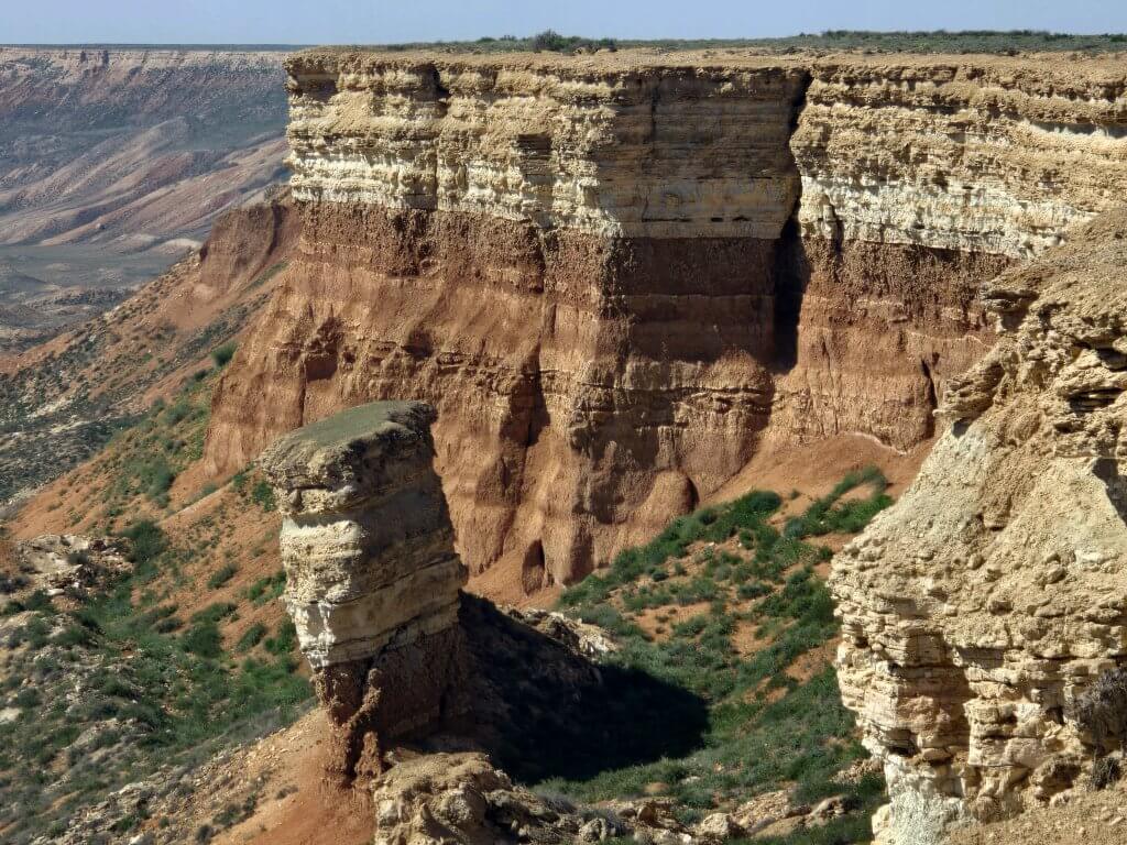
Exploring the Nature Reserve was a very enjoyable day off the bike – Sasha worked hard, firstly driving through sandy tracks along the Aral Sea North coast and the finale, some cross-country driving to the highest cliffs of the former island that fall away to the former seabed. It was a little scary standing near an estimated 70 metre drop with a gusting wind. Where once waves would have lashed the island and mist would have rolled in from the sea spray, now I looked out over an empty saline desert where sea mist has been replaced by fine salty dust.
Day 33 : Akbasty to Kylandhi +4km camp – 91km
I resumed the ride from where I turned off to go to Akbasty, following a maze of small tracks across the steppe. At one stage I lost Sasha’s tracks after light rain had erased them. It was quite alarming for me because there were no signs, and some tracks that would start as a parallel alternative to a deeply rutted track, might then peel off in another direction. I followed my instinct and fortunately rejoined the track Sasha was on a few kilometres later. It is easy to lose each other out here.
Sasha was worried his fuel would not last and he decided to divert 40km to Bozai, the only village for hundreds of kilometres, to top up. Once back on the Gas Pipeline Road, he and Georgia left me for what was meant to be a couple of hours while had to cycle 32km and stop at a small intersection. It was a tougher ride than predicted due to the powerful, blustery winds and heat. Communicating with Sasha was always a challenge due to the language barrier. On reaching the distance there was a kind of crossroad – no signs, just a faint sandy track. Could this be the right place to stop? It wasn’t clear, so I cycled further to see whether there were any other options. I half expected to see them waiting for me because I had taken longer than expected. There was nothing, so I turned back to the shadeless intersection and waited in the hot sun, getting very worried. A minivan stopped to see whether I was OK, loading me up with water and bread. Just after that, the team arrived and I was very relieved. It was the correct spot.
We turned off the Pipeline route and onto a very sandy track, made more difficult by the powerful cross winds.
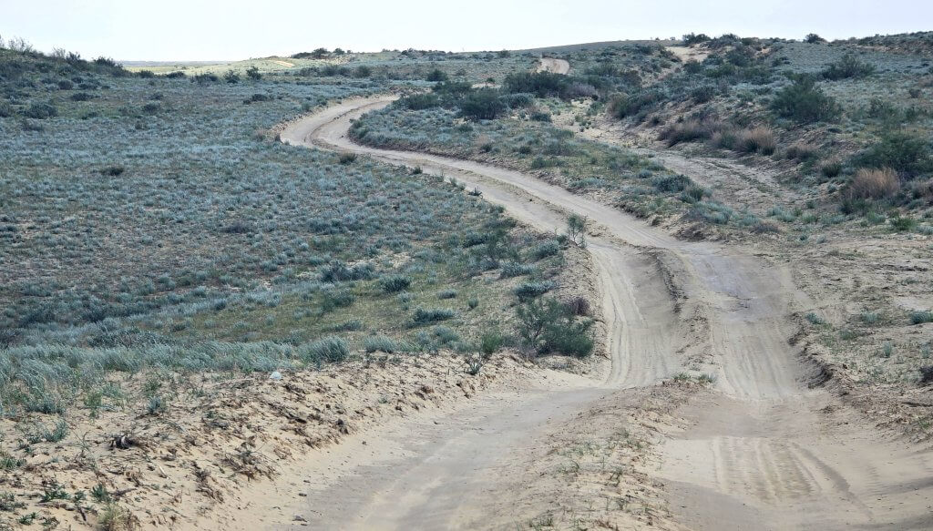
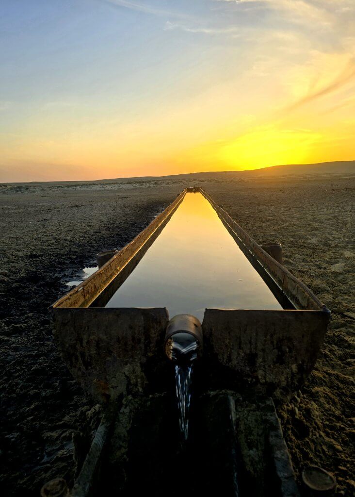
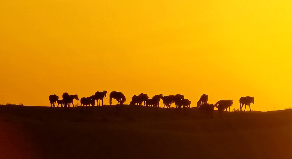
I pushed on for a further 30km, passing through Kylandhi, the last small village we saw in Kazalhstan, and set up camp amongst the sand dunes beside a natural spring used as a watering point for livestock. Horses and cows came to drink during the night, and check out who was camping at their watering hole!
Day 34 and 35: Kylandhi Camp to near the border – 110km
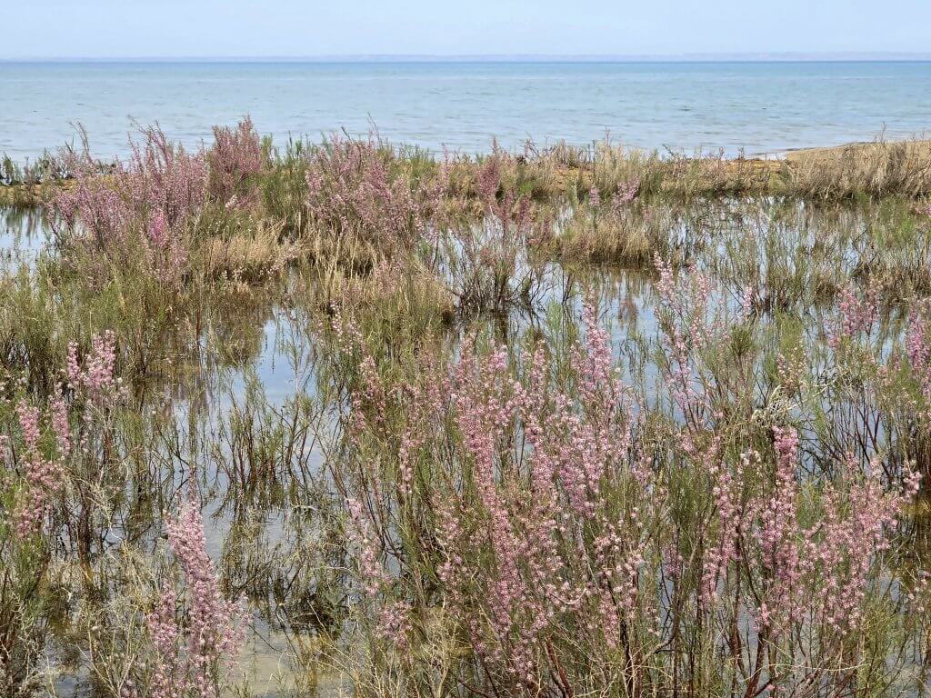
Reaching the border on Day 34 was always going to be a challenge, but it was a realistic goal if it hadn’t been for the vicious afternoon head winds. The highlight of the day came after about 26km, when we reached the Aral Sea South coast for the first time.
After taking our time capturing it on Sasha’s drone and on film, we decided to descend and follow a track at the base of the cliff. That lasted three kilometres before we hit heavy sand and decided to turn back. Plan B involved pushing into the relentless wind on soft sandy, overgrown tracks and sometimes on dried mud that had been trampled by camels. I was exhausted and with the drying wind I became dehydrated. At worst I was down to 9km/hour. It soon became evident I wasn’t going to get there on Day 34 and we camped on a salt lake (no scorpions or tics) with about 30km to do in the morning.
It was crucial that we got it done in good time as there was a 400km drive to do on questionable road to reach the town of Beineu to catch the train, booked for the early morning of the 28th April. Plan A was to head down the Pipeline road, but there was no longer a road, just a very rough track. So we diverted to the coast, about seven kilometres away. This happened to be the most spectacular piece of coastline I’ve seen; the Ustyurt plateau crumbling to the sea in layers of red (iron-based rock) and white (limestone-based rock).
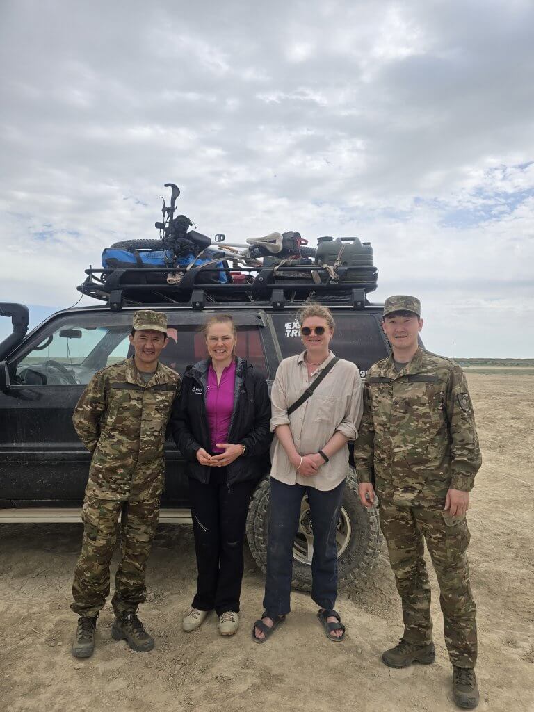
A few kilometres on, we were stopped by the border force. We had no idea there was a 25km border zone we were not meant to enter – there were no signs and previously, where we crossed the border by mistake on our first night in Kazakhstan, the prohibited zone was only 100 metres there. We were totally innocent. At first, when my team who were ahead of me was approached, the border guards were quite aggressive, but soon everything calmed down, probably thanks to Sasha’s approachable demeanour, and when they realised it was a genuine mistake.
We were led to the border police’s compound where we were questioned. Basically we had to prove who we were and the purpose of our travel. I think we became objects of curiosity as they probably don’t get much action on this remote border. This was the first time I had ever been detained, but it wasn’t too stressful, we just had to wait about an hour to be cleared. In that time two of the border guards offered Georgia and I an opportunity to have a shower. I guess we were a bit rough after being out a few days! This was as close as I was allowed to cycle to the border – about 15-20km short of the line. Although there was no photography permitted around the compound, before leaving two of the friendliest guards flipped their name badges and registration numbers and posed for a photo (with the caar as the backdrop.
Sasha packed the bike on the roof of his car and we set off, firstly on rough tracks to Bozoi, and then about 300km to Beineu in time to board the train for a 12 hour journey to Nukus in Karakalpakstan. The only road border crossing in this region was closed for renovation.
My cycling journey is to resume once my local support in Nukus drives Georgia and I back to a spot as close to the Kazakhstan/Uzbekistan border as possible.
FOLLOW THE JOURNEY
Thanks to ZeroSixZero, you can open this URL on your phone and select “add to home screen” and the map will become and app. You can then keep updated in real time: https://z6z.co/breakingthecycle/central-asia
TAKE ACTION
Support my Water.org fundraiser to help bring safe drinking water and sanitation to the world: Just $5 (USD) provides someone with safe drinking water or access to sanitation, and every $5 donated to my fundraiser will enter the donor into the Breaking the Cycle Prize Draw. https://give.water.org/f/breakingthecycle/#
EDUCATION
An education programme in partnership with Exploring by the Seat of Your Pants, with contributions from The Royal Geographical Society and The Duke of Edinburgh’s International Award Australia. We have created a Story Map resource to anchor the programme where presentations and updates will be added as we go.


Continuing your compelling epic, Kate….you are creating a valuable narrative, which must become a book. These pictures of the old cliffs of the Aral really demonstrate the scale of the change.
I had understood that parts anyway of the Aral were now being recovered. Is that true?
I have only just caught up with your progress and, once again, am awed by your endeavours. As for the logistics! I have read about the historical Silk Route, but had no idea of the devastating environment damage caused by the draining of the Aral Sea in the past 60 years. Enjoying the photos and blogs. What a journey… Good luck, Kate, and to all involved.
So love your story telling Kate…. you brush aside the many challenges as if it was as simple as if you just received the wrong meal and need to wait a tad longer. Keep on riding